Interactive GIS Web Apps

City Information Viewer
This application provides city related information to the public based on a user's input address. It shows whether an input address is located within the city limit and information about council district, council member, neighborhood and zoning.

Parks Finder
This application provides City of Columbia parks information based on a user's input address. It displays parks that are adjacent to a user's address.

Public Parking Deck Finder
This application provides City of Columbia parking information based on a user's input address or geolocation. It displays parking decks that are adjacent to a user's input.

Code Enforcement and Rental Property Viewer
This application provides information about Code Violations and Rental Properties.

Riverfront Park Story Map
This application features histories, scenic vistas, biodiversity, and healthy living as a story map style. All elements of a Southern Jewel at the City of Columbia's Riverfront Park.

City of Columbia Landmarks
This application features the City of Columbia's historic and modern landmarks with pictures and descriptions.

Fire Stations
This application provides fire station information based on a user's input address. It displays fire stations that are adjacent to a user's address.
GIS data and PDF Maps
Open Data Portal
City of Columbia's Open Data Portal to provide accessible, convenient and transparent information for those seeking details about our operations.
City Limits
This PDF map shows the current city limits for the City of Columbia. It is D-size (24"x36").
Council Districts
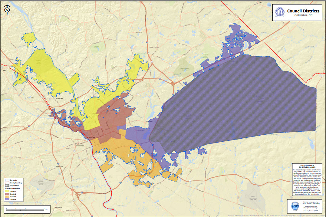
This PDF map shows the current City Council District boundaries. It is D-size (24"x36").
Click HERE to see individual Council Districts.
Voting Precincts and Polling Locations
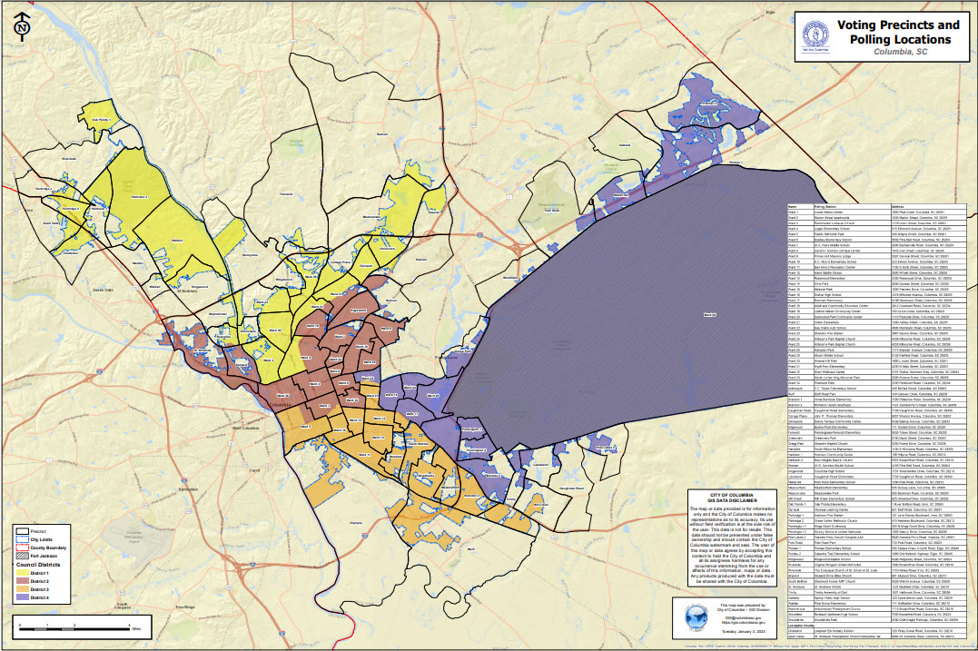
This PDF map shows the current Voting Precincts and Polling Locations for the City of Columbia.(24 x36)
Click HERE for more Election information.
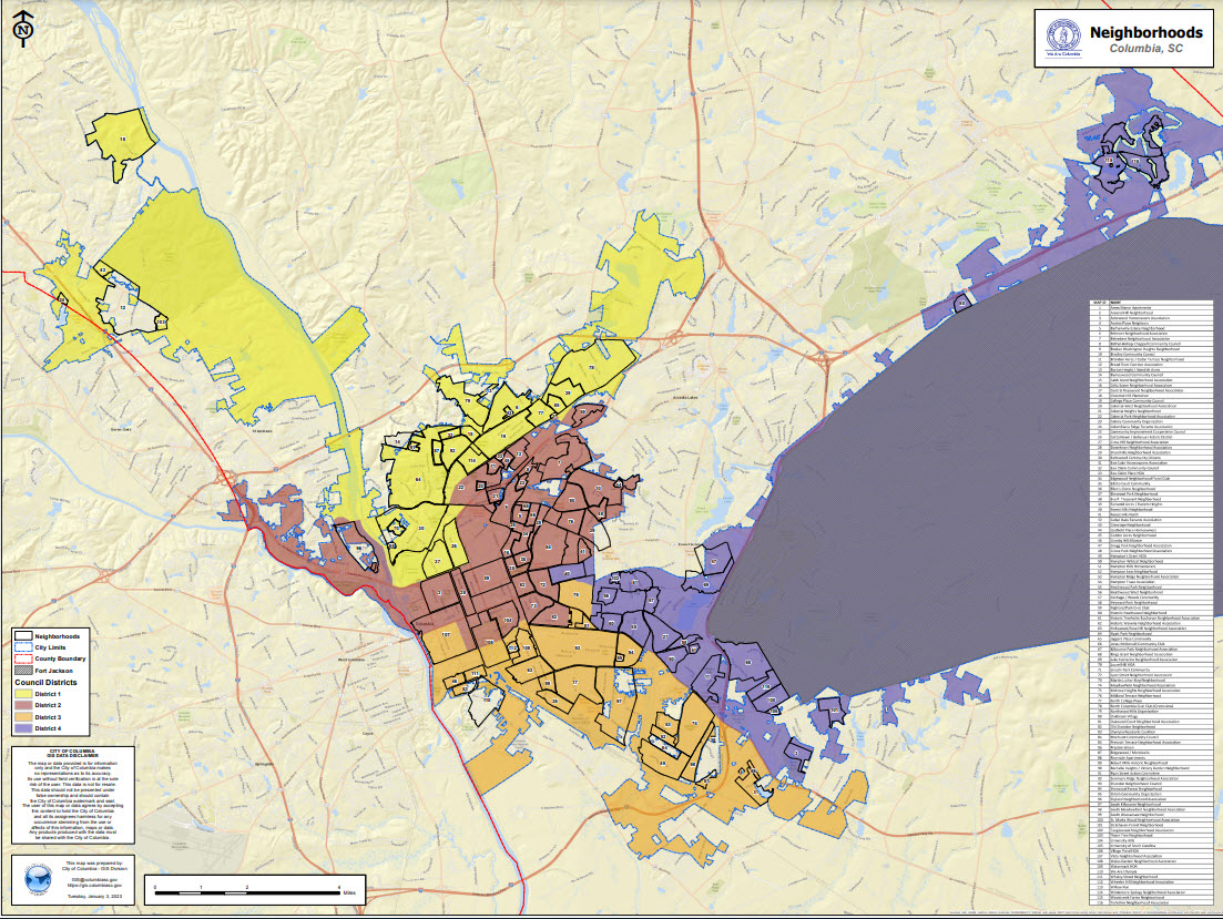
Neighborhoods
This PDF map shows neighborhoods by Council Districts. These maps are E-size (36"x48").
Click HERE to see individual neighborhood boundaries.
About The GIS Division
Our Mission
The mission of the GIS division is to provide the City government with access to comprehensive and accurate geosptial data as well as the tools necessary to utilize such information for improved problem solving and making informed decisions.
What We Do
We provide training, spatial data creation and management, geospatial analysis and GIS support services to all departments within the City. Additionally, the GIS Division develops, maintains and supports internal and public facing GIS web applications to provide better services to employees and citizens.
Data collection and development is the core of any GIS system. City GIS staff are proficient in the use of GPS (Global Positioning System) technology. This is used to accurately map city assets such as fire hydrants, water meters, manholes and even endangered Spider Lilies found along the beautiful rivers that flow in and around Columbia. This data collection not only serves to put a point on a map, but also provides information about the location. What type of fire hydrant is it? What flow rate does it have? When was it last serviced? This type of spatial and attribute information is the foundation of the City's work order management system and serves to insure City workers are able to complete work orders and address citizen concerns as they arise. Location, location, location... Everything has one and GPS and GIS technologies tie these locations to many of the City services relied on by the citizens of Columbia.

GIS Division
Email: gis@columbiasc.gov
Hours of Operation
Monday - Friday
8:30 - 5:00
Additional Contact Info:
City related questions should be directed to
Customer Care
for general information inquiry
Phone: 803-545-3300
Food Distribution Sites and Grocery Store Locations
City of Columbia, South Carolina... © 2022 - All Rights Reserved.


